Tag Archives: Mount Hamilton

Mount Hamilton the hard way / don’t trust Strava to create a route


It should have been a pretty straightforward ride to Mount Hamilton. Normally, Kevin and I take the train down to San Jose, and ride from the station up to the top, and back. About 50 miles round-trip. But today I decided to make it a bit tougher, riding all the way from Redwood City instead of taking the train (but on the return, catching the train in San Jose).

Of course, back in the day, my friends and I would do the complete round-trip by bike, just over 100 miles. I wasn’t ready for quite that much punishment and, besides, the roads were a lot easier to navigate back then (less traffic on city streets). Riding one-way there, train back, seemed like a reasonable compromise. But… how to get there? I considered just mapping it out in a straight-forward fashion, heading south on Foothill, then Stevens Creek into San Jose, pretty much what I did 44 years ago. Not much fun, right? So I tried Strava’s route creation feature, thinking I should take advantage of the various bike trails and paths. With a bit of mucking around, I had a route that, I thought, made sense.

One of several gravel trails Strava's routing software put us onto. We opted out of any further gravel excursions.
One of several gravel trails Strava’s routing software put us onto. We opted out of any further gravel excursions.

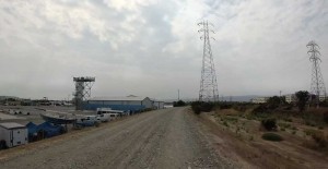
And it did make sense, until it routed us, more than once, onto gravel trails. Fine for a hybrid, not so great for a roadbike with light tires. Thankfully it wasn’t too tough to figure out how to route around the gravel trails, but it added quite a bit of time to the ride.

Surprisingly, despite the extra miles and stress getting to Mount Hamilton, we felt pretty good getting up it. A fantastic little Vietnamese coffee/sandwich shop we found probably helped in that regard.

There was some drama; either we timed things just right or way-wrong as we raced to the train station and had, literally, 90 seconds to spare. Just one more red light and we wouldn’t have made it, causing us to wait another hour for next train. Not fun fumbling with the ticket machine, trying to make sure we got that right, knowing the train was just about to pull out!

How tired was Kevin? Tired enough to put the wrong glove on the right hand!

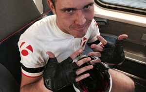
Overall, about 82 miles for the day. Kevin’s really tired; I’m ready for more! Unfortunately, “more” will have to wait for a few days, as I travel to the bike industry’s trade show tomorrow and miss both Tuesday & Thursday-morning’s rides. Hate that. Hopefully there will be cool stuff to see and bring in for customers though. –MikeJ

New Years Day Mt Hamilton ride details (check road conditions before heading out, due to fire)

Late-breaking news- due to a large grass fire near Grant Ranch, the road up Mt Hamilton might be closed. You may be able to get up-to-date info here; if there’s a yellow triangle on the map, click on it for any reference to road issues. You should also check the Caltrans site here. If both make no reference to road closures, we should be ok. –Mike–

We’re doing the annual New Years Day Mt Hamilton ride a bit differently this year, getting off to a much later-than-normal start because we’re taking the train! Anyone interested in joining us, we’ll be on the #422 CalTrain (the earliest southbound train on the holiday schedule) which leaves Redwood City at 9:07 and arrives in San Jose at 9:51am. From there plan on a 40 minute ride to the base of Mt Hamilton, so 10:30 should see us ready to go.

CalTrain #422 stops EVERYWHERE so you can join us anyplace along the way. If you haven’t taken a bike on CalTrain before, you’ll be placing it on a rack that stacks up to three other bikes next to it. I doubt the train will have that many bikes, but if it does, the potential for getting a scratch of two does exist. Also, good idea to write your final destination on a piece of masking tape and attach it to the top tube. For me, that would mean writing “REDWOOD CITY <======> SAN JOSE”. That way, on the way back in particular, people know not to stack a bike in front of yours if you’re getting off first.

Tickets for CalTrain have to be purchased BEFORE boarding, so allow a few minutes before arriving at the train station. Machines do take credit cards, even for small amounts.

If we start up the hill at 10:30, faster riders will be at the top by 12, slower riders 12:45 or so. Plan on spending 30 minutes at the top if it’s a beautiful day (which it should be!) and bring a camera! Also, bring crisp dollar bills for the coke machine. It will not accept soggy bills, so put them into a baggie and seal it. The descent is very long and not as fast as you’d think, so plan on an hour and a half ride back to the station, maybe even a bit longer. Returning trains leave from San Jose Caltrain every hour, on the hour, except for an extra train tossed in at 5:35pm. If you leave the top at 1pm, you should be able to make the 3pm return train.

If interested, send an email to MikeJ@ChainReaction.com so I have some idea if anyone’s coming. Not that it matters if it’s just two of us or 10… this ride goes on, no matter what.

The weather is expected to be in the upper 60s in San Jose but we could see as low as mid-40s on the climb and descent, so I’d recommend leg warmers, a light base layer, regular gloves and another pair of full-fingered, and a lightweight jacket. Hopefully you won’t need the extra clothing, but if you do, you’ll be really glad you brought it.

One last thing. Bring whatever you need to eat because, aside from cokes, you’ll be nowhere near a place you can buy food for four hours! Don’t risk bonking. It’s a long climb and you’re going to burn up a lot of calories.

–Mike–