But today would be different. To start with, up Page Mill Road. Page Mill has always been a tough one for me; one of the few climbs that, even after all these years, I’ve never been able to develop a rhythm for. Especially the bottom part, before the park. It never feels quite right, at least not until you get to the park entrance. Then, you can sink your teeth into it, until, between Gates 3 & 4, it sinks its teeth into you!
Not too bikes on Page Mill today, probably scared off by the heat, or threat of heat. Not a problem for us though, as I think our time in France, where it was frequently in the mid-90s and sometimes over 100, has recalibrated our bodies. We didn’t fly up the hill, but we didn’t die either. At just over 48 minutes, it was a respectable effort.
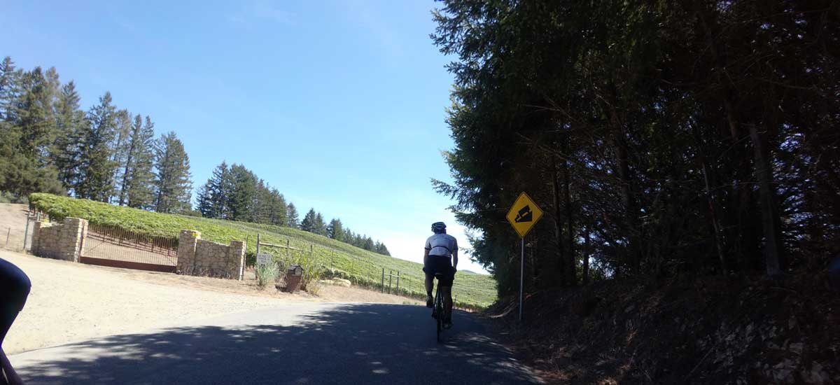
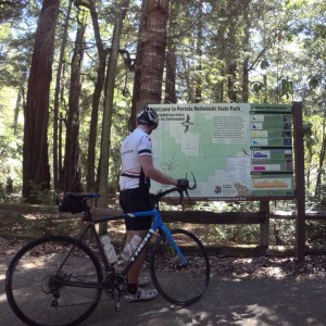
From there we dropped down the other side, descending West Alpine. Not all the way to the bottom though. At least not the bottom of West Alpine. Instead, we went to the real bottom of the world. Some would say into the depths of hell. All the way down to Portola State Park. Yikes. Check out the photo at the top; the bottom simply drops out of the road. Hard to believe that many, many years ago a couple of 13 or 14 year olds rode Schwinn Varsity 10-speeds, 40 pounders, down into that rabbit hole and back. I still remember how nasty the climb back out was, some 45+ years later!
A mile or two of dirt, almost all of it rideable on a normal road bike, and we were back on a paved road again, Camp Pomponio. It starts out nicely; maybe a 6-8% grade, shaded by trees, broken pavement but easy to find a nice path up. That lasts for less than a mile; then it’s straight up! Whatever your lowest gear is, you’re likely to be using it. It’s also entirely exposed, as you can see in the photo. Thankfully, it is not endless, and before you know it you’re back at West Alpine again. 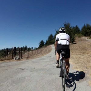
From West Alpine it was a fast run downhill back to LaHonda, detouring, of course, past the Duck Pond. Before heading east (home) on 84, we stopped at the LaHonda market for a Coke and, I’ll admit it, a Snickers bar. Interesting thing about that Snickers bar was the expiration date- June 2016. Yikes. Either that means a ton of preservatives or it must be the freshest, just-made Snickers bar ever. Well, it didn’t taste fresh, so the safe assumption is that my body probably will now be self-embalming.
One of the most-interesting things about this ride was the run up 84 from LaHonda to Skyline. It was fun! Usually, that’s a bit of a grind, but today it just felt really, really good. A great way to end the ride (although it doesn’t really “end” at Skyline; it’s another 10 miles downwhill and through Woodside to get home to Redwood City).


