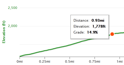
The original plan had been to ride the Primavera Century, but by the time I got around to trying to register, they were full-up. Darn, it’s one of my favorite rides, next to the Sequoia Century. So instead Kevin and I take advantage of what was supposed to be a gorgeous day for another Santa Cruz loop.
The Strava account doesn’t tell the story. Yes, 112 miles, yes, about 9000ft of climbing, yes, best time so far for Kevin and I from Boulder Creek up to Skyline. But what’s missing from the bare stats are a fierce headwind the entire 25 miles on the coast from Gazos Creek to Santa Cruz, making one of the more enjoyable sections of the ride a real challenge, nor does it explain how the weather forecast could be so wrong! The hourly forecast for Pescadero and Davenport had the fog clearing fairly early in the day, so our late start (10:30) should have seen nice weather on the coast.
Well let me tell you about that nice weather. It was great all the way to Pescadero, and about 4 miles south on Cloverdale. Actually we already knew the weather wasn’t going to be kind to us as soon as we made the left turn onto Cloverday and ran into a stiff headwind. But not long after that we hit cold fog, which kept us company all the way to Santa Cruz and a few miles up Highway 9.
Cold & damp weather wasn’t doing much for Kevin’s spirits, and I came very close to turning around on highway 1 and heading north, but that wasn’t the plan, and there was something to be said for the challenge of riding 25 miles into a headwind.
The mandatory stop at Davenport’s Whale City Bakery gave me a chance to look at the updated forecast; the “now” temperature showed 52 degrees (at 1:58pm) while the 2pm hourly forecast said 74 & sunny. Eating outside, and drinking cold Mtn Dew instead of coffee or hot chocolate, was probably a mistake! But refueled and recharged we motored on, finding the headwind gradually diminishing as we approached Santa Cruz, and the intense traffic actually providing a needed distraction from the fog & cold for Kevin. Strange but true.
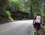
Heading up Highway 9 things gradually warmed up to pretty much perfect conditions for climbing, and by the time we got to the start of the main event (the climb first up to Waterman Gap and then Skyline), we were in pretty good shape. In fact, the mandatory Boulder Creek stop didn’t find us buying food or drink; we just ate a Honey Stinger Waffle and were good to go. Funny how you can do a hard bike ride and eat less than if you didn’t ride at all!
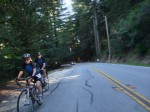
Funny also how, once the main climb starts, you feel more comfortable, more settled, more like you’re getting somewhere. And funny how 40 miles to go seems like you’re almost there! At Saratoga Gap (Skyline and Highway 9) we picked up drinks from Mr. Mustard, who thankfully doesn’t start shutting down until 5pm and we arrived at precisely 4:59. Good timing! The run across Skyline and down into Woodside was welcome and pleasant, feeling very much like we were on “our” turf. Home. And almost exactly 8 hours after we left, there we were, back home.
Oh, the remark about “If you can’t control you weather, you can’t control your life!”? A mild alteration of a Calvin & Hobbes comic where Calvin is upset that his mom doesn’t scoop the peanut butter out exactly the right way, and exclaims “If you can’t control your peanut butter, you can’t control you life.” Wise words indeed! –Mike–
